Catalog Archive
Auction 155, Lot 683

Plan of an Island Used in the Slave Trade to the Americas

"Plan de l'Isle de Gore avec Ses Fortifications", Bellin/Van Schley

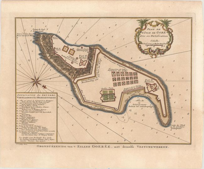
Subject: Goree Island

Period: 1765 (circa)

Publication: Prevost's Histoire Generale des Voyages

Color: Hand Color

Size:
10.7 x 7.8 inches
27.2 x 19.8 cm
Download High Resolution Image
(or just click on image to launch the Zoom viewer)

A plan of Goree Island, which is located on the west coast of Africa, to the southeast of Cape Verde peninsula in the harbor of Dakar, Senegal. This strategically located island was used for the ivory, gold, and slave trade to and from Africa and the Americas. The island was first fortified by the Dutch in the early 17th century, and later seized by the French in 1677 to be used as their slave trading center to the Indies. The plan shows the extensive fortifications with Fort St. Michel, Fort St. Francois, and several supporting batteries. Decorated with a French style cartouche, compass rose and rhumb lines, with a key to the map at left. Engraved by Van Schley.

References:

Condition: B+

A nice impression with attractive color on watermarked paper with light toning.

Estimate: $70 - $85

Sold for: $50

Closed on 11/18/2015

Archived