Subject: Africa
Period: 1784 (circa)
Publication:
Color: Hand Color
Size:
25.2 x 18.6 inches
64 x 47.2 cm
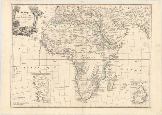
This handsome map of the continent shows the extent of European geographical knowledge in the mid-18th century. Much of the interior is still a mystery. While mostly accurate, the map does have remnants of fantasy such as the twin lake source of the Nile in the Les Montagnes de la Lune, which in this depiction is quite a bit north of the Equator. Southern Africa is occupied by the Hottentots tribes. Notes on the natives and the land are peppered throughout the map. Two insets focus on the Cape of Good Hope and Mauritius, respectively. The pictorial title cartouche features a majestic lion and some palm trees. Based on the Janvier map of the continent first published in 1762.
References:
Condition: A
On a sturdy watermarked sheet with faint damp stains at top and minor soiling that is mostly confined to the blank margins.