Subject: Asia
Period: 1652 (dated)
Publication: L'Asie en Plusieurs Cartes Nouvelles, et Exactes
Color: Hand Color
Size:
10.9 x 7.6 inches
27.7 x 19.3 cm
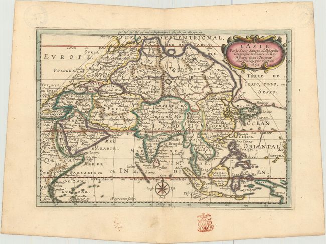
Attractive and intriguing map of the continent and the East Indies with the cartography of the larger Sanson map of 1652. This map shows a large and dramatic version of Terre de Iesso, drawn from the discoveries of the Maarten de Vries expedition of 1643. Here Sanson incorporated De Vries' information by combining Hokkaido and the southern Kurils into a huge island, shown with the two place names of le Tessoy P and Matzumay. Korea is depicted as an island. West of China is the large lake, Lac de Chiamay, with four rivers flowing south. Part of New Guinea is also shown, identified as the Terre des Papous. This is the first state, engraved by A. Peyrounin.
This map was deaccessioned from the Universitat und Landesbibliothek Sachsen-Anhalt in 2010. Documentation is available upon request.
References: Pastoureau, SANSON III A [1]; Yeo #46.
Condition: B+
A crisp impression with original outline color, later color in the cartouche, color offsetting in a few spots, and a hint of toning along the centerfold. There are library stamps in the top corners of the sheet on verso, confined to the blank margins. There is a previous owner's stamp in the bottom blank margin.