Subject: England & Wales
Period: 1843 (dated)
Publication:
Color: Hand Color
Size:
12 x 15.2 inches
30.5 x 38.6 cm
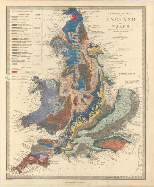
The beginning of the nineteenth century saw a period of rapid market growth and innovation in the map publishing world. Increased literacy and public interest in new frontiers and colonies overwhelmed the market because it was oriented toward the small, affluent market of the previous century. With the intent to fill this void, The Society for the Diffusion of Useful Knowledge (SDUK) was founded in 1828 in London, by Lord Brougham and a group of men dedicated to the education of the aspiring working class and the Utilitarian ideal of 'Knowledge is Power.' The society produced an array of education materials, but the series of maps was one of their most successful ventures. A number of engravers and printers were used to produce the maps, which eventually exceed 200 sheets, and continued to be published after the Society as a whole ceased to function.
Superb thematic map with bright hand coloring to illustrate twenty geological types. Filled with fascinating details such as the location of the quarries where the building stones for Parliament were taken, fossil beds, and mineral and gem deposits. Drawn by S.P. Woodward, engraved by J & C Walker, and colored by T. Malby. This is one of the few maps we have ever seen that identifies the colorist, attesting to the incredible workmanship presented in the coloring of this map.
References:
Condition: A
Bold original color on thick, watermarked paper with very minor soiling confined to the blank margins.