Subject: England
Period: 1720 (circa)
Publication: Britannia Depicta...
Color: Black & White
Size:
5.8 x 7.6 inches
14.7 x 19.3 cm
Britannia Depicta Or Ogilby Improv'd was the most popular and successful Ogilby derivative atlas, published in response to public demand for a small road atlas that could be easily carried by travelers. The atlas reproduced Ogilby's strip-style road maps and added individual county maps. It was published by Thomas Bowles in a series of editions between 1720 and 1764. The historical notes that accompany each map were compiled by John Owen, a respected lawyer and antiquarian. The maps were engraved by Emanuel Bowen who went on to become one of London's leading engravers and print sellers in the 18th century. The maps are embellished with coats of arms and contain immense detail and topographical information. A compass rose orients each map and useful landmarks include hills, bridges, rivers and streams, windmills, churches, markets, parks and forests, water wells and even gallows.
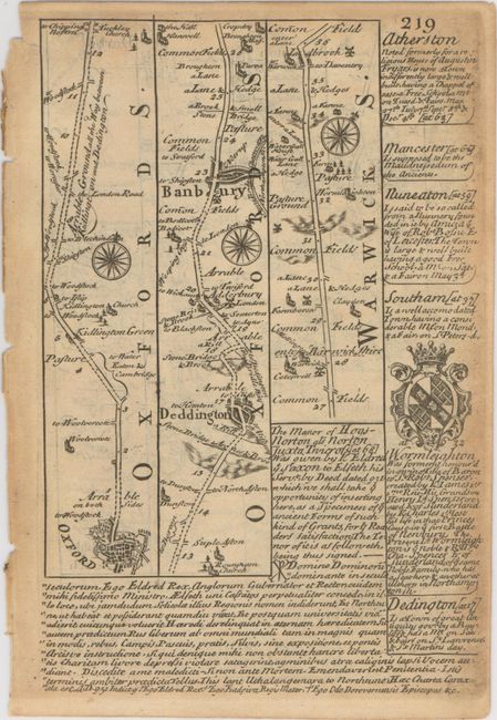
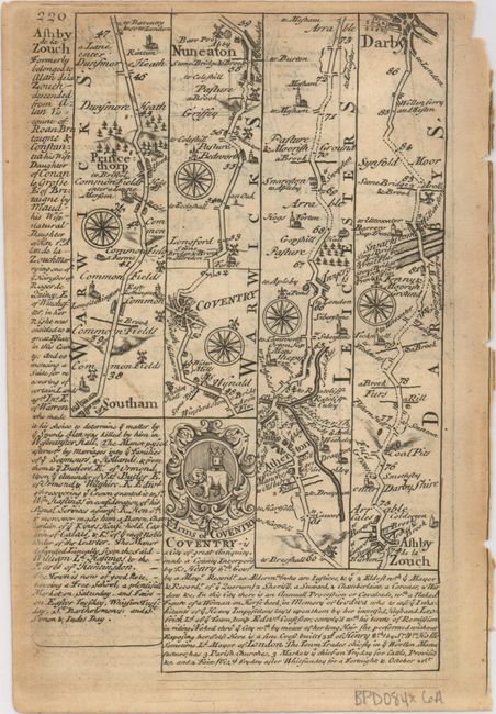
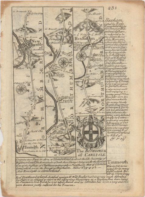
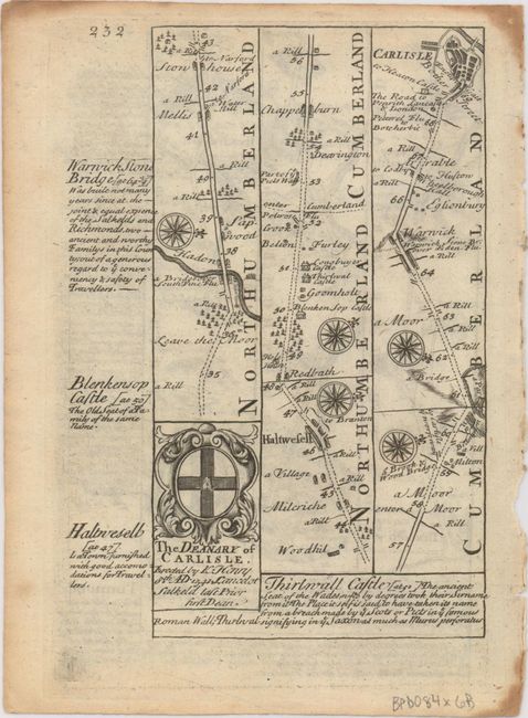
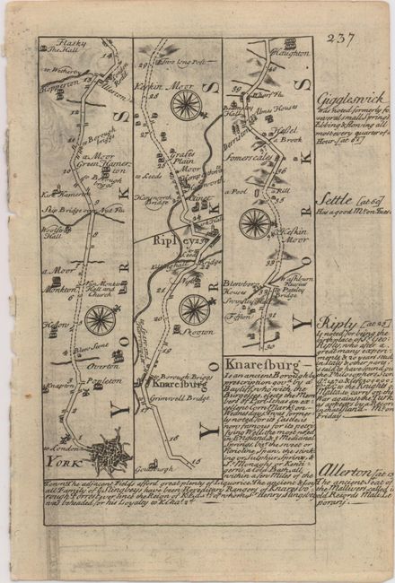
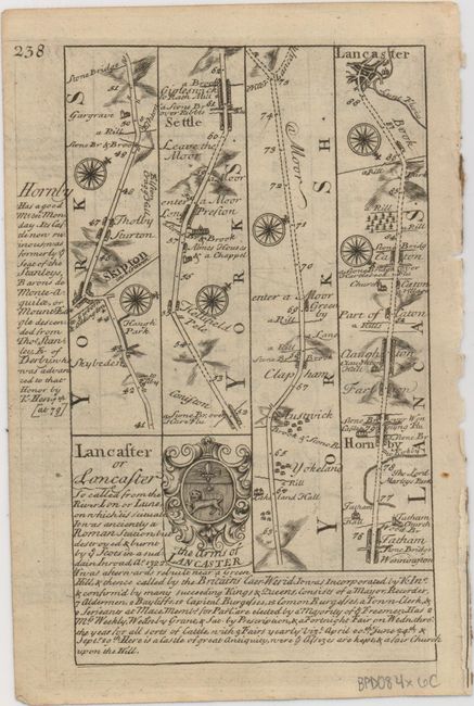
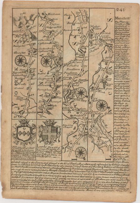
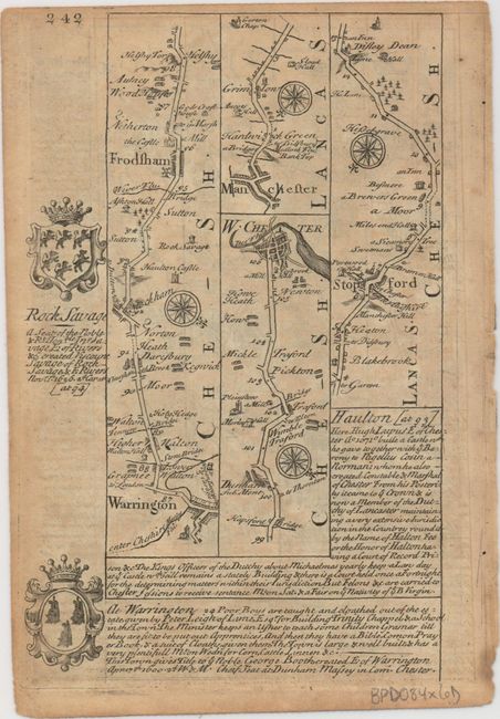
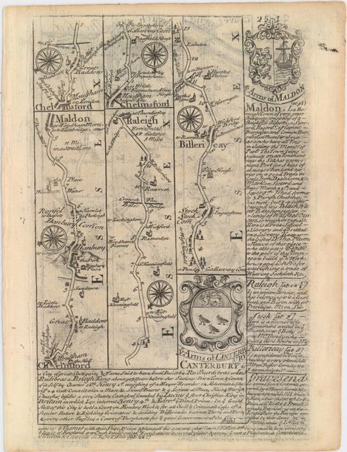
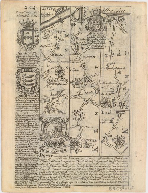
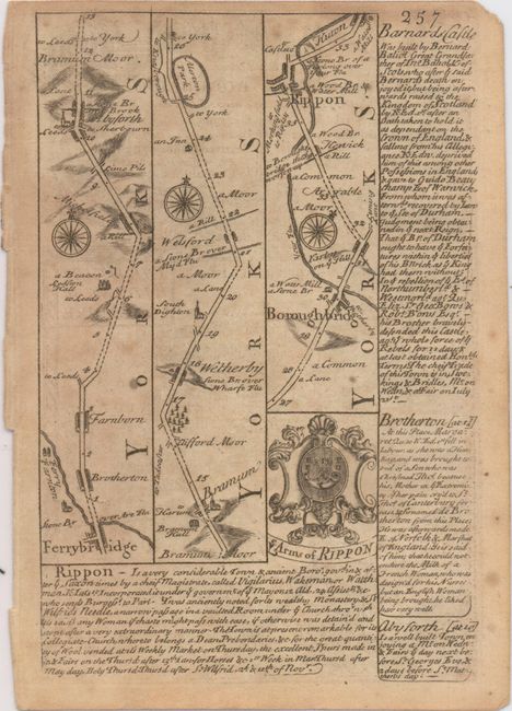
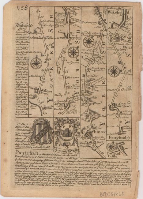
This lot of copper engraved, Ogilby-style strip road maps includes coats-of-arms and descriptive text by John Owen. The first map, from the series The Road from Oxford to Coventry Continued to Derby... // Warwickshire, starts in Oxford and goes through Warwickshire and Leicestershire on its way to Derby in Derbyshire. The second map appears on pages 231 and 232 of the series The Road from Tinmouth Com. Northumb. to Carlisle... // A Map of Norhumberland [sic] and begins in Tynemouth and follows the course of the River Tyne through Newcastle upon Tyne and Hexham out of Northumberland and into Cumbria, terminating in the town of Carlisle. From the series The Road from York to Lancaster... // Lancashire, the third map traces the route from York to Lancaster. The fourth map consists of pages 241 and 242 from the series The Roads from York to West Chester... // A Map of Cheshire and goes from near the border of West Yorkshire and Lancashire through Manchester, Warrington, Frodsham, and Chester, with a second map beginning on page 242 that focuses on the border between Lancashire and Cheshire, which were connected before the creation of Greater Manchester. From the series The Road from Chelmsford to Maldon & Raleigh ... & Gravesend... // A Map of Kent, the fifth sheet shows maps that extend from Chelmsford to Maldon, from Chelmsford to Rayleigh, from Chelmsford across the Thames to Gravesend, and from Canterbury through Sandwich and Deal to Dover. The final sheet is part of the series The Road from Ferribridg to Borobridg... // The West Riding of York-shire and features maps covering North and West Yorkshire, with one map traveling from Ferrybridge to north of Richmond and another from Ferrybridge to Wakefield, with Barnard Castle depicted as well as part of another map. Size varies slightly.
A. [The Road from Oxford to Coventry Continued to Derby... // Warwickshire]. Condition: A dark impression on a watermarked sheet with light toning and minor show-through of text on verso. (B+)
B. [The Road from Tinmouth Com. Northumb. to Carlisle... // A Map of Norhumberland]. Condition: A nice impression with one tiny wormhole only visible when held to light and toning in the corners of the sheet, away from map image. (A)
C. [The Road from York to Lancaster... // Lancashire]. Condition: A nice, dark impression with faint offsetting from an opposing page. (B+)
D. [The Roads from York to West Chester... // A Map of Cheshire]. Condition: A nice impression on a lightly toned sheet with minor show-through of text on verso. (B+)
E. [The Road from Chelmsford to Maldon & Raleigh ... & Gravesend... // A Map of Kent]. Condition: On watermarked paper with light show-through of text on verso. (A)
F. [The Road from Ferribridg to Borobridg... // The West Riding of York-shire]. Condition: A nice impression on a lightly toned sheet with minor scattered foxing. (B+)
References: Shirley (BL Atlases) T.BOW-1a.
Condition:
See description above.