Subject: England
Period: 1720 (circa)
Publication: Britannia Depicta...
Color: Black & White
Size:
5.6 x 7.8 inches
14.2 x 19.8 cm
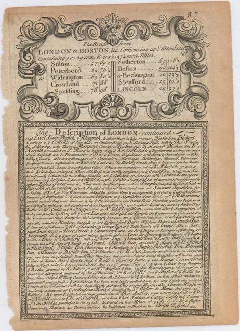
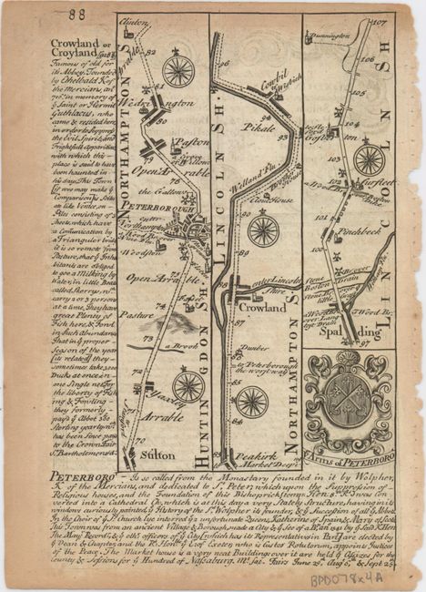
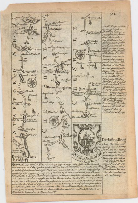
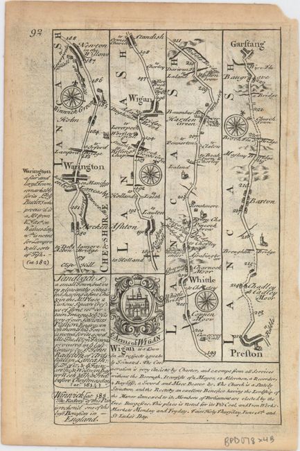
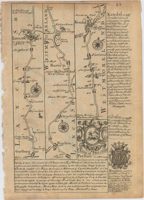
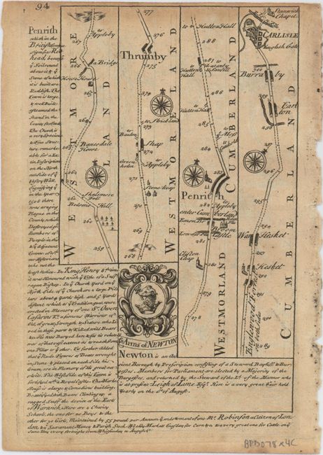
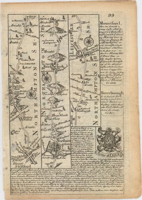
Britannia Depicta Or Ogilby Improv'd was the most popular and successful Ogilby derivative atlas, published in response to public demand for a small road atlas that could be easily carried by travelers. The atlas reproduced Ogilby's strip-style road maps and added individual county maps. It was published by Thomas Bowles in a series of editions between 1720 and 1764. The historical notes that accompany each map were compiled by John Owen, a respected lawyer and antiquarian. The maps were engraved by Emanuel Bowen who went on to become one of London's leading engravers and print sellers in the 18th century. The maps are embellished with coats of arms and contain immense detail and topographical information. A compass rose orients each map and useful landmarks include hills, bridges, rivers and streams, windmills, churches, markets, parks and forests, water wells and even gallows.
This lot of copper engraved, Ogilby-style strip road maps includes coats-of-arms and descriptive text by John Owen. The first sheet is pages 87 and 88 from The Roads from London to Boston &c..., featuring the title and a portion of Owen's description of London on the recto and a road map from Huntingdonshire (now part of Cambridgeshire) into Lincolnshire via Northamptonshire. The second and third sheets comprise the Darlaston Bridge to Carlisle section of the The Road from London to Carlisle... // A Map of Staffordshire series. The final sheet covers the portion of The Road from London to Darby Commencing at Stony Stratford... // A Map of Darbyshire extending from Stony Stratford in Buckinghamshire to Derby. Size varies slightly.
A. [The Roads from London to Boston &c...]
B. [The Road from London to Carlisle... // A Map of Staffordshire]
C. [The Road from London to Carlisle... // A Map of Staffordshire]
D. [The Road from London to Darby Commencing at Stony Stratford... // A Map of Darbyshire]
References: Shirley (BL Atlases) T.BOW-1a.
Condition: B+
Light toning primarily along sheet edges with several edge chips and tears confined to the blank margins.