Subject: Britain
Period: 1749 (dated)
Publication: Atlas Homanninus...
Color: Hand Color
Size:
21.1 x 18.4 inches
53.6 x 46.7 cm
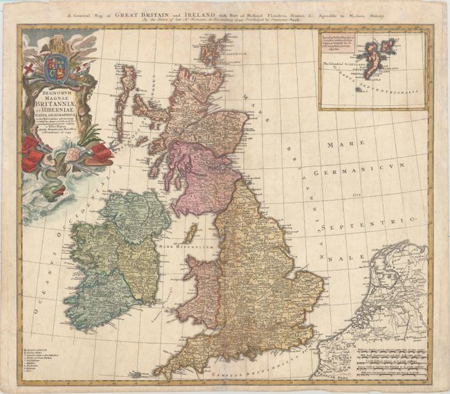
This handsome map of the British Isles includes very good detail of Ireland, England, Scotland, Wales, and the island groups of Orkney and the Outer Hebrides. The map extends to include the adjacent parts of Holland and Belgium with five distance scales below. At upper right the inset chart details the Shetland Islands. A key at lower left includes symbols for cities, towns, villages, universities, forts and redoubts. The large, ornate title cartouche is decorated with a sea monster, shells, a coat of arms and the accoutrements of battle. Titled in English along the top of the map.
References:
Condition: B+
A nice example with minor soiling and archival repairs to short centerfold separations at top and bottom and several tiny tears in the top blank margin.