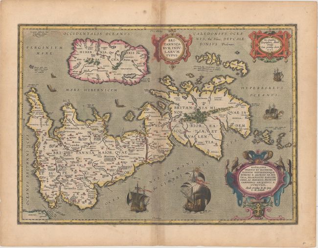
Subject: Britain
Period: 1595 (dated)
Publication: The Theatre of the Whole World
Color: Hand Color
Size:
20.1 x 14.4 inches
51.1 x 36.6 cm
This handsome map of Roman Britain is based on information from Mercator's 1564 map of the British Isles, a new outline from Saxton's 1579 map, and ancient knowledge from Diodorus, Siculus, Plinius, Appianus, Tacitus, Caesar, and Strabo. The map is filled with ancient place names, and Hadrian's Wall and Wall of Pius (mislabeled Severi Imp. Murus) are located. Richly embellished with three large strapwork cartouches and several sailing vessels. Engraved by Jan Wierix. This example was included in the English edition of Theatrum Orbis Terrarum, published in 1606, with English text on verso.
References: Shirley (BI to 1650) #186, plt. 42; Van den Broecke #192.
Condition: B+
A nice impression in full original color on a watermarked sheet with light toning along the centerfold, a centerfold separation that just enters the border at bottom, and light color offsetting.