Subject: North Atlantic, Iceland
Period: 1758 (circa)
Publication: Prevost's Histoire Generale des Voyages
Color: Black & White
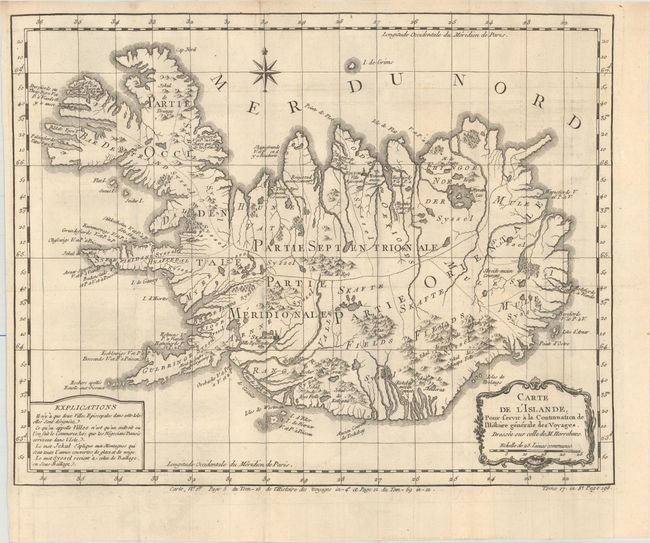
A. Carte de l'Islande, pour Servir a la Continuation de l'Histoire Generale des Voyages..., circa 1758 (15.0 x 11.9"). In 1752 the Danish scholar, Niels Horrebow, published an important book and map about Iceland. His map, based on the previously unpublished Knoff survey, was a major departure from previous maps based on Bishop Gudbrandur Thorlaksson's map of more than 150 years earlier. Thus, it marked a turning point in the cartography of Iceland. This is Bellin's version for Prevost's important work on voyages of exploration. The map locates villages and churches and graphically delineates the mountains, rivers, lakes and forests. A note at bottom left explains that there are only two Episcopalian villages on the island, which are so marked, and that the term "village" on this map simply identifies a location where commerce occurs when "the Danish negotiators arrive on the island."
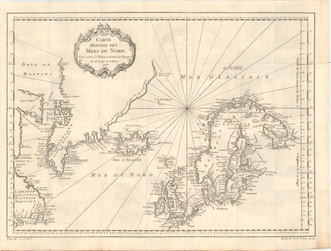
B. Carte Reduite des Mers du Nord, pour Servir a l'Histoire Generale des Voyages, dated 1758 (17.8 x 13.1"). This nice chart is centered roughly on Iceland and covers from the eastern shores of Canada through Greenland to Scandinavia and Britain. The coastlines are intricately drawn with coastal place names the only detail. A fine chart with decorative title cartouche and rhumb lines.
References:
Condition: A
Issued folding on watermarked paper with faint offsetting, otherwise fine.