Catalog Archive
Auction 155, Lot 363

"Carte de Lisle de Saint Christophle Situee a 17 Degrez 30 Minutes de Lat. Septentrionale", Labat, J. B.
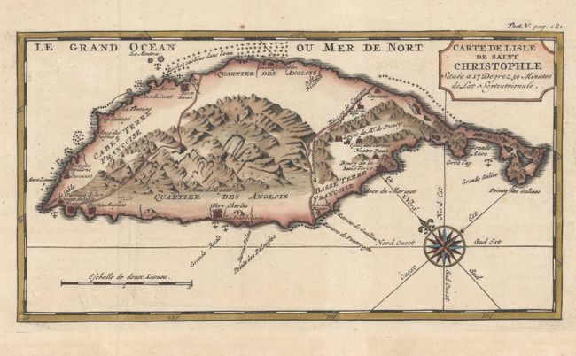
Subject: St. Kitts

Period: 1724 (published)

Publication: Nouveau Voyage aux Isles de L'Amerique

Color: Hand Color

Size:
9.6 x 5.1 inches
24.4 x 13 cm
Download High Resolution Image
(or just click on image to launch the Zoom viewer)

This handsome small map of the island of St. Kitts shows the island divided into French and British regions, although the French were expelled from the island in 1702. The mountainous topography is dramatically illustrated, and several forts and small towns are identified. A compass rose orients north to the top left of the map. This example appeared in the 1724 edition of Labat's Nouveau Voyage aux Isles de L'Amerique, published by P. Husson in The Hague.

References: Tooley (MCC-81) St. Kitts #17.

Condition: A

A nice impression with attractive color and wide margins. There is light toning confined to the blank margins, and an archivally repaired tear in the right blank margin.

Estimate: $180 - $210

Sold for: $100

Closed on 11/18/2015

Archived