Subject: Gulf of Mexico & Caribbean
Period: 1773 (published)
Publication: Raynal's Atlas Portatif
Color: Hand Color
Size:
14.7 x 10.6 inches
37.3 x 26.9 cm
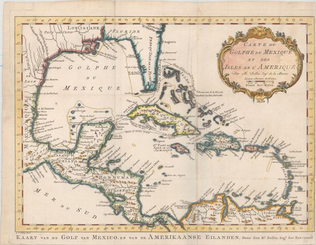
Attractive map of the islands of the Caribbean with the parts of the United States and Mexico that border the Gulf of Mexico, Central America, and the northern coastline of South America. Routes of several explorers are shown, including Cortez, Ponce de Leon, and Hernandez de Cordova, along with many coastal place names. A delicately engraved rococo-style title cartouche fills the upper right. Dutch title at bottom: Kaart van de Golf van Mexico, en van de Amerikaaanse Eilanden. Engraved by Van Schley.
References:
Condition: B+
A crisp impression on watermarked paper with very minor soiling and a couple of printer's creases east of Florida. Issued folding, now pressed, and trimmed to the neatline at right.