Subject: Gulf of Mexico
Period: 1818 (published)
Publication: Portulano de la America Setentrional
Color: Black & White
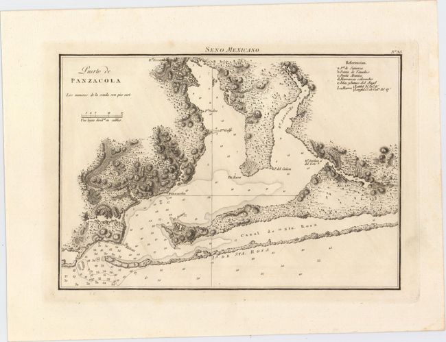
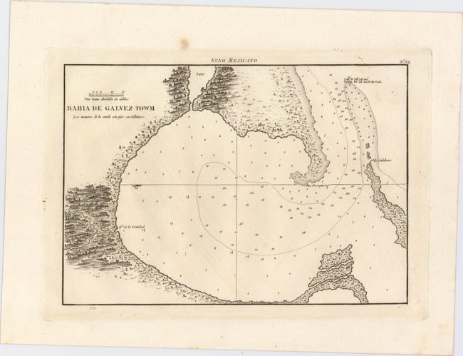
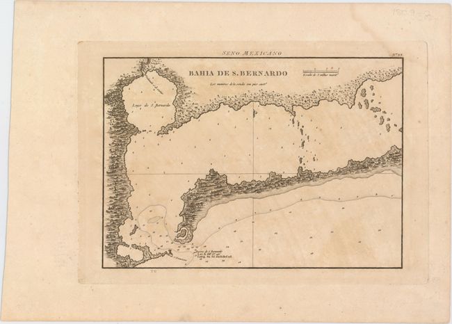
This rare set of Spanish maps is from the second edition of Portulano de la America Setentrional... and depicts several important ports along the Gulf Coast including Matagorda Bay, Galveston, Mobile and Pensacola. The maps are finely engraved to illustrate the topography of the coast with numerous soundings, shoals and anchorages identified. Engraved above the neatline at top is Seno Mexicano, and the engraver's initials "TG" are imprinted directly below the bottom neatline with the exception of the Mobile plate.
A. Puerto de Panzacola, (10.8 x 7.4").
B. Bahia de Galvez-Towm, (10.4 x 7.3").
D. Plano de la Bahia de Movila: Situado el Fuerte del Mismo Nombre..., (10.4 x 7.1").
C. Bahia de S. Bernardo, (10.1 x 7.2").
References: Streeter #1043A & #1044A; Phillips (A) #1224 #33-35, #41.
Condition: B+
Dark impressions on watermarked paper with ample margins. The maps of Pensacola and Galveston have faint toning, while the map of Matagorda Bay has light toning and a damp stain in the top right corner of the sheet that just touches the neatline.