Subject: Central America, Railroads
Period: 1838-53 (circa)
Publication:
Color: Black & White
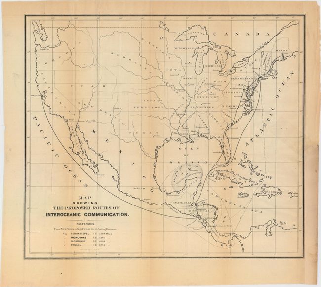
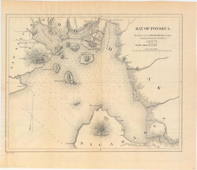
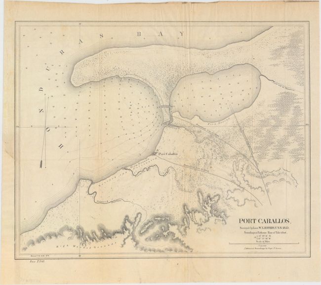
These three maps were published in the preliminary report of the Honduras Interoceanic Railway company by E.G. Squier. The first map demonstrates the various routes connecting New York to San Francisco through Honduras. A table below the title indicates that this route was the shortest of the four proposed routes through Central America (Tehuantepec, Honduras, Nicaragua, and Panama). The final two maps show the end points of the proposed Honduran rail line in Port Caballos and Bay of Fonseca. Each shows several proposed roads, a proposed railway terminus and numerous soundings. Despite construction commencing on this line, the project was abandoned in the 1870s with the Panama Canal on the horizon.
A. Map Showing the Proposed Routes of Interoceanic Communication, circa 1853, by Sarony & Co., (14.0 x 12.2"). Condition: Light toning along the folds with a faint old tape stain at right. There is a binding trim at lower right that has been replaced with old paper and an associated closed 2" binding tear at right.
B. Bay of Fonseca, by Capt. Sir Edward Belcher, dated 1838 (15.2 x 11.9"). Condition: Binding trim at lower left that has been replaced with old paper.
C. Port Caballos, by Lieut. W. N. Jeffers, dated 1853 (15.3 x 12.3"). Condition: A few tiny spots and a binding trim at lower left that has been replaced with old paper.
References:
Condition: B+
Issued folding and now flattened and backed with tissue. See description above for additional details.