Catalog Archive
Auction 155, Lot 335

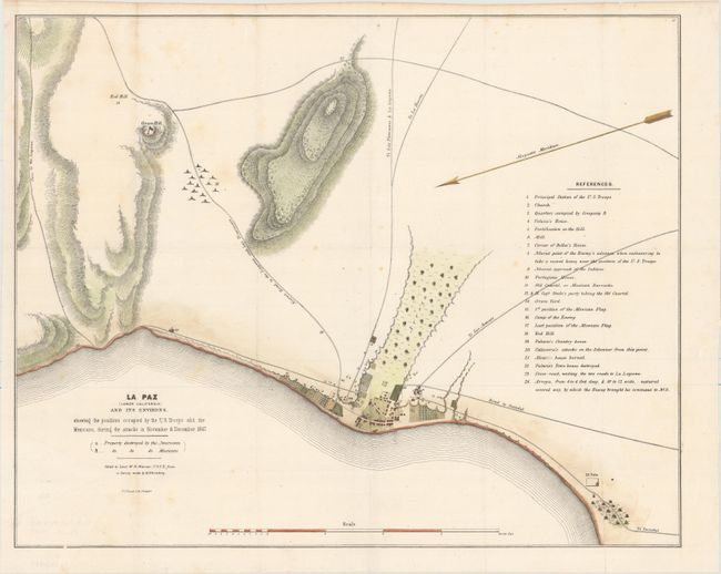
"La Paz (Lower California) and Its Environs, Showing the Positions Occupied by the U.S. Troops and the Mexicans, During the Attacks in November & December, 1847", U.S. Government

Subject: La Paz, Mexico

Period: 1848 (circa)

Publication:

Color: Hand Color

Size:
20.5 x 16.5 inches
52.1 x 41.9 cm
Download High Resolution Image
(or just click on image to launch the Zoom viewer)

This Mexican-American War map depicts the positions occupied by the U.S. Troops and the Mexicans during the attacks in November and December 1847. Roads, topography, and a bird's-eye plan of the town are illustrated. An extensive numbered key identifies numerous locations on the map. Copied by Lieutenant W.H. Warner from a survey by H. Ehrenberg, and lithographed by P.S. Duval in Philadelphia.

References:

Condition: B+

Issued folding, now pressed with a few spots of foxing, minor staining, and several minor mis-folds.

Estimate: $140 - $170

Unsold

Closed on 11/18/2015

Archived