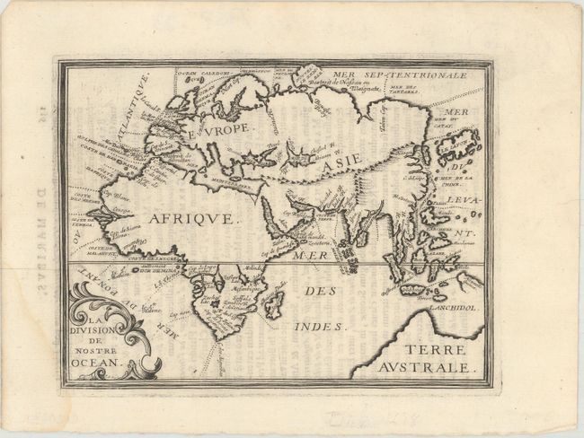
Subject: Eastern Hemisphere
Period: 1649 (published)
Publication: Parallela Geographiae Veteris et Novae
Color: Black & White
Size:
7.3 x 5.6 inches
18.5 x 14.2 cm
This map of the eastern hemisphere identifies each of the oceans and shows the divisions between them. The Atlantic Ocean is named Mer du Ponant ou Atlantique and the Pacific is Mer du Levant. There are place names of capes and rivers along the coastlines, and interior detail is limited to a few mountain ranges, lakes and rivers. A large Terre Australe is shown at bottom right, with a partially delineated Nouvelle Guinee. Korea is shown as an island. Latin text on verso.
References: Pastoureau, BRIET I [22].
Condition: B+
A fine impression on watermarked paper with light show-through of text on verso and a faint damp stain at bottom left.