Catalog Archive
Auction 155, Lot 32

"Theatrum Historicum ad Annum Christi Quadringentesimu in quo tum Imperii Romani... / An Historical Map of the Roman Empire and the Neighbouring Barbarous Nations...", Moll, Herman

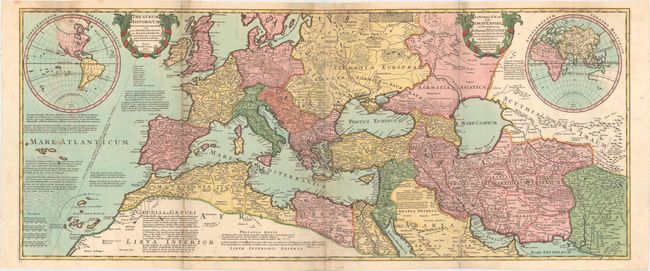
Subject: Ancient World

Period: 1709 (dated)

Publication: The World Described; or, A New and Correct Sett of Maps...

Color: Hand Color

Size:
46 x 19 inches
116.8 x 48.3 cm
Download High Resolution Image
(or just click on image to launch the Zoom viewer)

This large-scale map of the Roman Empire in the year 400 AD includes all of Western Europe and Northern Africa and extends into South-central Asia. Cartouches contain the Latin title at left and the English title at right and maps of the Western Hemisphere and Eastern Hemisphere are inset. The map was derived from Delisle's cartography and is filled with extensive, often fanciful, notations, which are the hallmark of Moll's maps. One indicates that a gold coin stamped with the effigy of Augustus Caesar was found in an American gold mine, confirming the probability that the Roman penetrated as far as the New World. Two sheets joined, as issued.

References: Phillips (Maps) p. 258

Condition: B+

Issued folding on watermarked paper with a few tiny tears along the inner left fold and two small worm tracks along the centerfold that have been backed on verso with old paper. Minor soiling.

Estimate: $500 - $650

Sold for: $600

Closed on 11/18/2015

Archived