Subject: United States, Mexico & Central America
Period: 1851 (published)
Publication: H.R. Doc. 2, 32nd Congress, 1st Session
Color: Hand Color
Size:
14.1 x 13.6 inches
35.8 x 34.5 cm
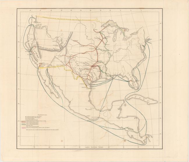
This untitled map of the United States shows the new borders with Mexico and Canada and identifies army posts, old army posts, land transportation routes and river/ocean transportation routes. A line from the mouth of the Sabine River in Louisiana north to Lake Superior indicates the "Extreme Limit of Line of Frontier Stations." Stations to the east of this line were primarily accessible by steamboat and railroads while stations to the west of the line were reached by wagon only. The famous "March of the Rifle Regiment in 1849" from Ft. Leavenworth to the Columbia River is also depicted. Wheat quotes the original report stating "The accompanying map will show more clearly than any written statement possibly can, the great difference between the country occupied by the troops on the 30th of June, 1845, and at the present time."
References: Wheat (TMW) #728.
Condition: B+
Issued folding with light offsetting, a few spots of foxing, and a nearly invisible 1.5" tear in a blank area of the map image that has been closed on verso with archival tape.