Subject: World
Period: 1896 (dated)
Publication: National Geographic Magazine
Color: Printed Color
Size:
47.7 x 27 inches
121.2 x 68.6 cm
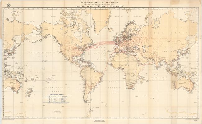
A large and fascinating map (drawn on Mercator's projection) that shows routes over the ocean joining the land-based communication lines. Extensive legend identifies coaling, docking and repair facilities by the size and power of cable laying vessels they can accommodate. All countries of the world shown in outline and named. This example bears a rubber stamp "Natl Geog. Mag. Vol. VII, 1896, Pl. X" in the blank ocean below the Explanation of Symbols. This is one of the earliest maps appearing in the National Geographic Magazine - it was included in the issue of March, 1896 according to Buxbaum in his "Collector's Guide to the National Geographic."
References:
Condition: B+
Issued folding with faint toning along the folds and the top blank margin. There are a few tiny splits at fold intersections closed on verso with archival tape, a binding trim at left, and an adjacent 6" binding tear through Russia that has also been closed with archival tape.