Catalog Archive
Auction 155, Lot 22

"Carte de l'Ancien et du Nouveau Monde, Suivant une Projection Nouvelle, pour les Premieres Etudes; Dirigee par Mr. Philippe...", Philippe De Pretot, Etienne Andre
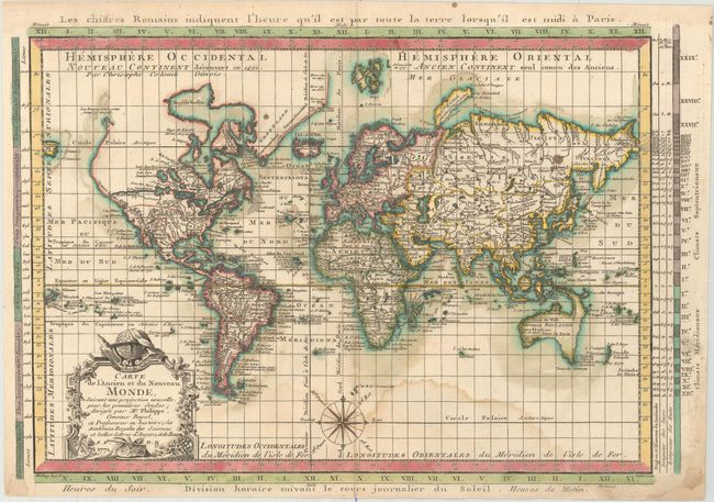
Subject: World

Period: 1771 (dated)

Publication: Atlas Universel

Color: Hand Color

Size:
16.3 x 10.9 inches
41.4 x 27.7 cm
Download High Resolution Image
(or just click on image to launch the Zoom viewer)

A very uncommon world map designed in a crisp style and presented on Mercator's projection. The map is very detailed, particularly in the oceans with recent discoveries noted in Greenland, Canada, the South Pacific and North Pacific. In North America a huge River of the West (Fl. de l'Ouest) is the most prominent feature and the northwest coast is lacking any hint of the Alaskan peninsula. Conjectural coastlines connect Australia to both Tasmania and New Guinea, and only a partial coastline of New Zealand is shown. The composition is nicely decorated with an elaborate, French-style title cartouche and a compass rose. Engraved by Jean Emmanuel Jerome Vallet.

References: Mickwitz & Miekkavaara #179-3.

Condition: B

A nice impression with attractive color and a damp stain at bottom.

Estimate: $400 - $475

Sold for: $300

Closed on 11/18/2015

Archived