Subject: United States
Period: 1861-63 (circa)
Publication:
Color: Hand Color
Size:
21.5 x 13.4 inches
54.6 x 34 cm
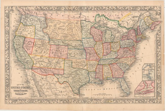
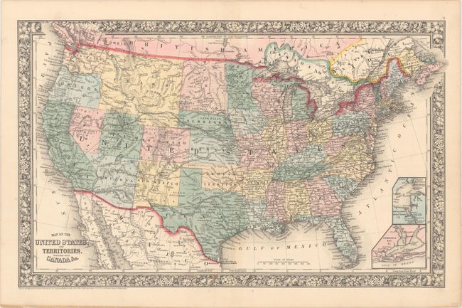
A nice pair of Mitchell maps during this highly transitional period when western territorial boundaries were quickly reformed. The first map features the newly established Colorado Territory, a skinny Nebraska Territory extending to the large Utah Territory, Dacotah reaching to the Rocky Mountains, and the Confederate Territory of Arizona occupying the region below New Mexico Territory. The second map shows a very large Idaho Territory encompassing all of Wyoming and Montana. Utah is still wider on its western border with Nevada while Arizona includes the southern tip of Nevada.
References:
Condition: B+
Original color with just a few spots of foxing and a few edge tears confined to the blank margins that have been closed on verso with archival tape.