Catalog Archive
Auction 155, Lot 123

"A New and Accurate Map of Quebec and Its Boundaries; from a Late Survey", Anon.

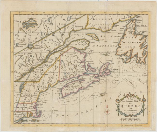
Subject: Colonial Northeastern United States & Canada

Period: 1781 (published)

Publication: Universal Magazine

Color: Hand Color

Size:
12.8 x 10.6 inches
32.5 x 26.9 cm
Download High Resolution Image
(or just click on image to launch the Zoom viewer)

The focus of this map is much broader than the title indicates. It extends from the coast of Labrador to Long Island and inland to include Lake Mistassin in Ontario and Lake Champlain. New Hampshire takes in all of present-day New Hampshire and Vermont, and Maine is unnamed. The map shows a number of early settlements, forts, and Indian tribal territory.

References: Jolly #UNIV-193; Kershaw #1013; McCorkle #781.8; Seller & Van Ee #583.

Condition: B+

Issued folding on watermarked paper with several mis-folds, now pressed flat with light soiling. A binding trim at bottom right has been replaced with old paper to accommodate framing, and an adjacent 1" binding tear has been archivally repaired.

Estimate: $200 - $230

Sold for: $150

Closed on 11/18/2015

Archived