Catalog Archive
Auction 155, Lot 121

"A Map of New England, and Nova Scotia; with Part of New York, Canada, and New Britain & the Adjacent Islands of New Found Land Cape Breton &c.", Kitchin, Thomas

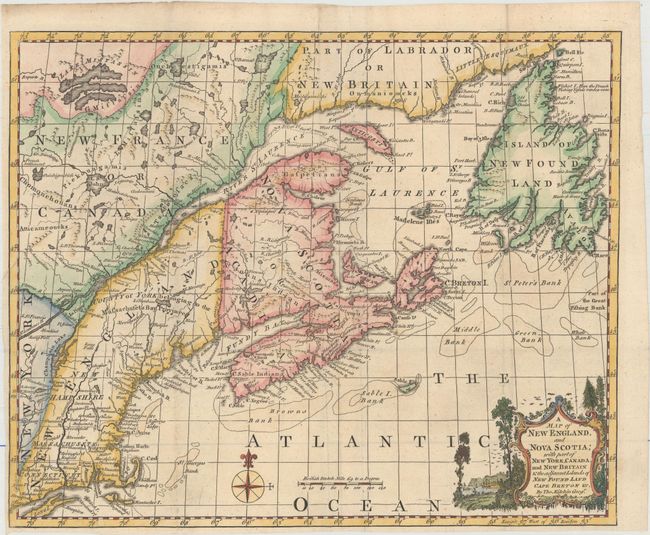
Subject: Colonial Northeastern United States & Canada

Period: 1758 (published)

Publication: London Magazine

Color: Hand Color

Size:
13 x 10.6 inches
33 x 26.9 cm
Download High Resolution Image
(or just click on image to launch the Zoom viewer)

This scarce map of eastern Canada and Newfoundland extends south to Long Island. It illustrates the theater of the French and Indian War at a time when the tide began to turn in favor of the British. The map depicts harbors, towns, forts, and even waterfalls. Several Indian tribal territories are named, including Chomonchouans and Atticameoueks. There is good detail of the fishing banks in the North Atlantic.

References: Kershaw #708; Sellers & Van Ee #80; Jolly #LOND-145; McCorkle #758.7.

Condition: A

Issued folding on watermarked paper with a few minuscule holes only visible when held to light and a narrow left margin.

Estimate: $250 - $325

Sold for: $180

Closed on 11/18/2015

Archived