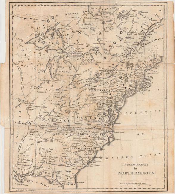
Subject: Eastern United States & Canada
Period: 1809 (circa)
Publication: Mavor's History of the Discovery and Settlement...of North and South America, and of the West Indies
Color: Black & White
Size:
13.3 x 15.8 inches
33.8 x 40.1 cm
This fascinating map of the Eastern United States and Canada features the short-lived states of Franklinia in eastern Tennessee (here labeled Tennassee) as well as Morgania in present-day Missouri. The latter was named after George Morgan, a land speculator, who attempted to create a new colony in the then Spanish controlled Louisiana Territory near New Madrid (Morgan gave up this endeavor a few years later). Ohio is not yet named and the Ohio Company land grant still appears north of the Ohio River. Florida is divided between East and West. West of the Appalachians, detail is mostly limited to forts and the locations of numerous Indian tribes.
References:
Condition: B
Issued folding and now flattened and backed with tissue to reinforce and repair several short separations along the upper fold. Uneven light toning and faint offsetting.