Subject: Colonial Canada & United States, Exploration, River Longue
Period: 1703 (published)
Publication:
Color: Black & White
Size:
3.7 x 6.3 inches
9.4 x 16 cm
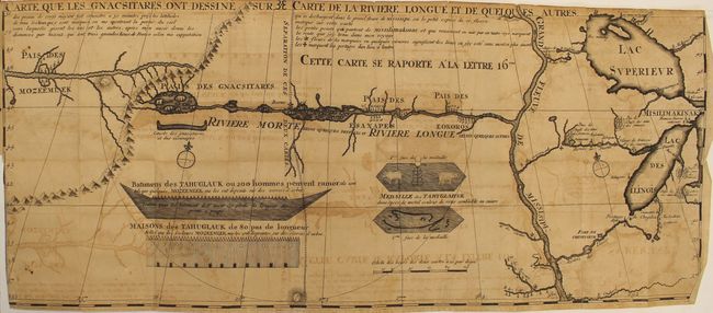
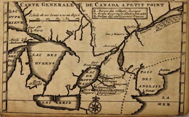
According to Howes, this is the first edition of this influential work, published in the Hague in 1703. It contains two (of three) important maps including the large folding Carte que les Gnacsitares ont Dessine sur ... Carte de la Riviere Longue et de Quelques Autres qui se Dechargent dans le Grand Fleuve Missisipi … (11 x 26") which is one of the most influential, and fanciful, maps in American cartographic history. It purports to show the Riviere Longue flowing from the western mountains, home to the Gnacsitares Indians, and connecting to the Mississippi River. On the western side of the mountains is another river, presumably flowing into the Pacific. Lahontan's concept was copied by virtually all 18th century cartographers including Moll, Senex, Popple, and Delisle, thus perpetuating the myth. The map also includes balloon-shaped Lakes Superior and Michigan. This is the scarce first state without a longitudinal scale at the top. Printed on two sheets, joined as issued.. Also included is the small Carte Generale du Canada en Petit Point (3.5 x 5.5") which shows the Great Lakes, Boston, Manhattan (Manat) and the St. Lawrence River. Also locates the lands of the Iroquois, Fort Niagara, Fort de S. Joseph, Sault Ste. Marie, Montreal and Quebec.
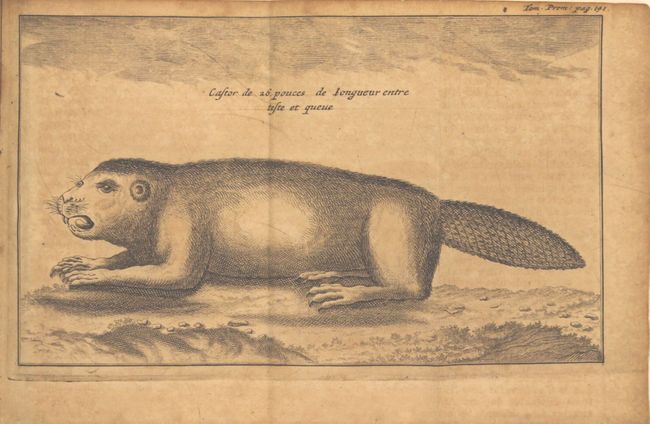
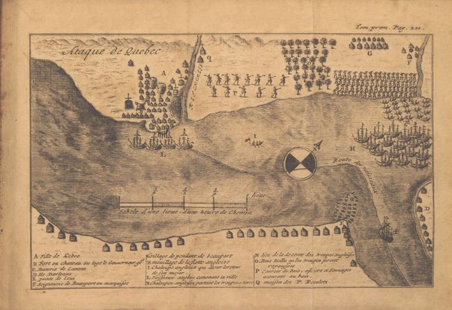
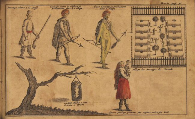
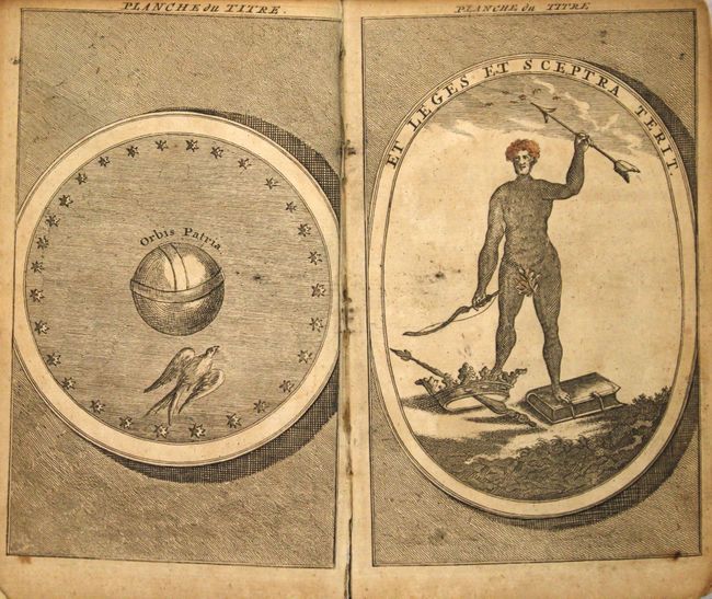
In addition to the maps, there are a total of 20 (of 26) plates with some hand coloring, including three frontispieces, a beaver plate, and "Ataque de Quebec" among others. Two volumes in one (279 pp. and 220 pp.) including the "Petit Dictionaire de la Langue des Sauvages," a very early Algonquin and Huron dictionary. Hardbound with vellum spine over paper boards.
Louis Armand, Baron de Lahontan served ten years in the French military in Canada, was involved in the Indian Wars, and commanded several posts in the west. He traveled extensively in the Wisconsin and Minnesota region and the upper Mississippi Valley. Upon his return to Europe he wrote this enormously popular travelogue. In it he embellished his knowledge of the geography of the Great Lakes region, invented Indian tribes, and created several fictions, particularly the River Longue, which he claimed extended from the Mississippi River to the Rocky Mountains. Over twenty editions of his book were published between 1703 and 1741, including editions in French, English, Dutch and German. The immense popularity of the book resulted in his distorted cartography being accepted by several eminent cartographers who incorporated the "Lahontan" concepts into most 18th century maps.
References: Howes #L25; Kershaw #282 & #298; Verner & Stuart Stubbs #20; Lemmon, Magil & Wiese (LA) #14.
Condition: C+
The maps, plates and text are moderately toned. In addition to the toning, the large folding map has moderate offsetting, a 3" binding tear, and a 5" fold separation that have both been closed on verso with archival tape. Four of the plates have long tears in the image, and 2 others have partial losses. Binding is tight with bumped edges and light shelf wear.