Subject: Eastern Canada
Period: 1878 (circa)
Publication:
Color: Printed Color
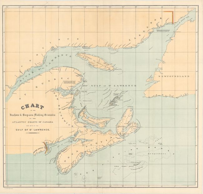
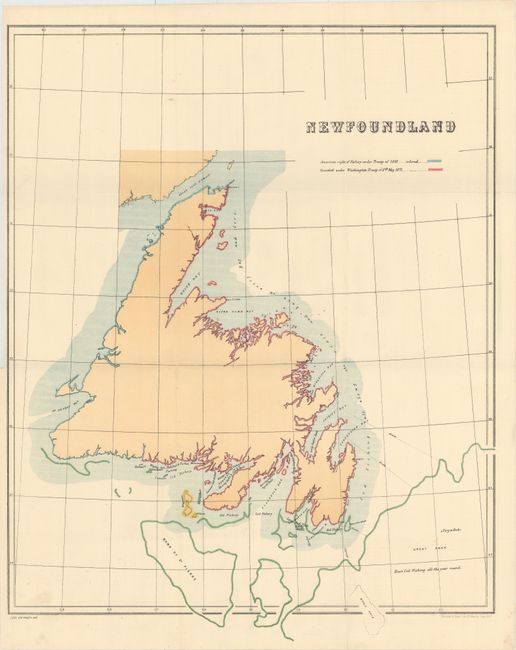
These two attractive maps show very good detail on types of fish, location, and seasonal variation along the eastern coast of Canada and the Great Banks. The map of Newfoundland is also color-coded along the coast to identify areas under "American right of Fishery under Treaty of 1818" and "Conceded under Washington Treaty of 8th May 1871." Published in an 1878 Parliamentary paper regarding the Halifax Fisheries Commission. Lithographed by Harrison & Sons.
A. Chart of the Inshore & Deep-Sea Fishing Grounds on the Atlantic Coasts of Canada and Within the Gulf of St. Lawrence (26.3 x 24.4"). Condition: There is a faint extraneous crease at top left, otherwise fine.
B. Newfoundland (19.9 x 24.9"). Condition: A minor spot of soiling at bottom left.
References: Phillips (Maps) p. 203.
Condition: A
Clean, bright examples issued folding. See description above for more detail.