Subject: Canada & United States
Period: 1814 (published)
Publication: New General Atlas
Color: Hand Color
Size:
23.5 x 19.7 inches
59.7 x 50 cm
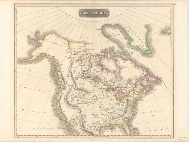
Handsome map of the continent showing the latest discoveries in the western parts of Canada and the United States including those of Mackenzie, Hearne, and Lewis & Clark. The map extends to include the northern part of Mexico. The Rocky Mountains are shown with an incorrect westward bulge and there is no Great Salt Lake. The Missouri River is projected too far west and is labeled "course of the Missouri according to the sketch of Capt. Lewis." Along the western coast are a number of British names: New Norfolk, New Cornwall, New Hanover, New Georgia (in present-day Washington and Oregon) and New Albion (California). Many Indian tribes are named including Snake, Plume, Red, Blue, Wolf, and Beaver.
References: Wheat (TMW) #319.
Condition: A
An attractive example with original color on watermarked paper and a few small areas of faint color offsetting.