Subject: Pacific Islands, Australia
Period: 1887 (dated)
Publication:
Color: Black & White
Size:
38 x 25.7 inches
96.5 x 65.3 cm
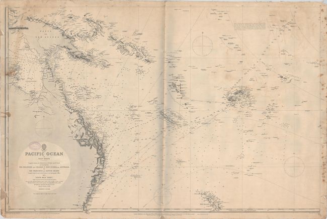
This is the southwest sheet of this massive chart of the Pacific that spreads over four sheets. It extends from Papua New Guinea and the eastern portion of Australia to the Cook Islands. New Zealand's North Island, the Solomon Islands, America Samoa, Fiji, Tonga, Niue, and many other small islands are located. Soundings, reefs, sea lights, bottom types, hazards, and more navigational information are shown. Drawn by R.C. Carrington, engraved by Davies & Company, published under the supervision of Captain Frederick James Evans, and sold by J.D. Potter. Dated 1875, but corrected up to 1887.
References:
Condition: B
Lighthouses are marked in original color. Backed in linen, as issued, with a number of short tears along the edges of the sheet where the linen has separated, as well as along the centerfold. There are light stains and some soiling. There is a small chip that enters the border at bottom left. The shadows along the centerfold in the image are a product of the scanning process and are not visible on the map itself.