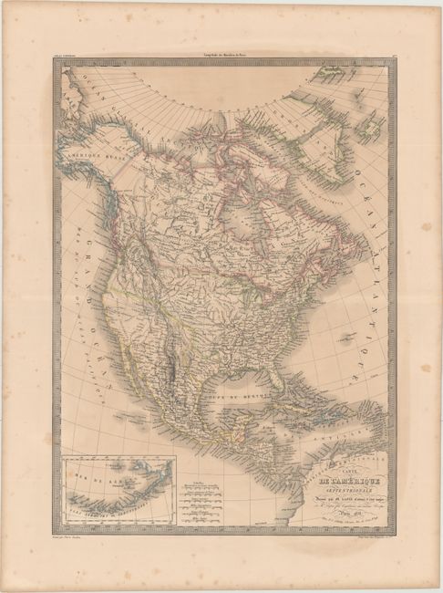
Subject: North America, Texas
Period: 1838 (dated)
Publication: Atlas Universel
Color: Hand Color
Size:
15.7 x 21.8 inches
39.9 x 55.4 cm
This is an interesting 19th century map of the continent showing the United States in an evolving configuration. The boundary between the United States and Canada reflects the United States claims in the disputed Columbia region (Oregon) and there is an independent Republic of Texas. Alaska is named "Amerique Russe". The map shows good detail of cities, rivers, and locations of Indian tribes, but does not show state or territorial boundaries. At lower left is an inset of the Aleutian Islands and Bering Sea. Engraved by Pierre Tardieu.
References:
Condition: B
Original outline color with light toning, a large damp stain covering most of the map, and light scattered foxing confined to the blank margins.