Subject: Northwestern Africa
Period: 1730 (circa)
Publication:
Color: Hand Color
Size:
22 x 18.8 inches
55.9 x 47.8 cm
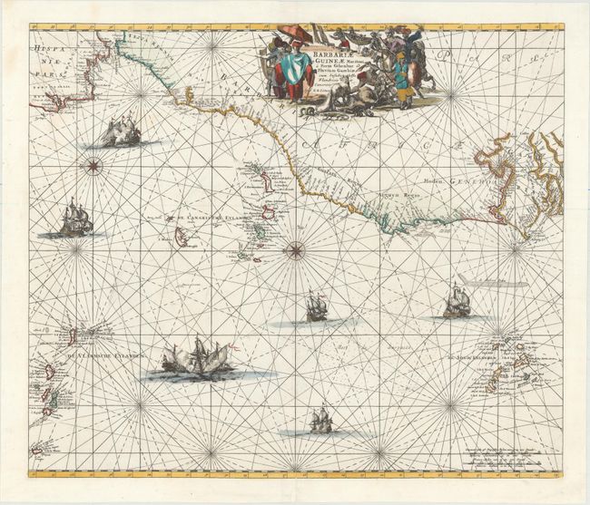
This decorative sea chart of the Barbary and Guinea coasts extends to include part of the coastline of Portugal and Spain. Two compass roses orient north to the left, and there is good detail of the Azores, Madeira, Canary, and Cape Verde Islands. Additional detail is confined to the coasts with numerous place names. The interior of Africa is filled with a decorative title cartouche depicting fat-tailed sheep, a lizard, and snakes in the foreground, with African pirates, merchants and slave-traders. The man at front right holds a scimitar in one hand and a decapitated head in the other hand. The map is further embellished by several sailing vessels, while others are engaged in battle. This is the Ottens edition of the map that was first published by Frederick de Wit, circa 1675.
References: Norwich #252.
Condition: B+
A bright example with a nice impression and attractive color. There are faint stains at top left and professional repairs to two 1/2" tears near the compass rose at center and a small hole in the bottom portion of the compass rose with the image skillfully replaced in facsimile.