Subject: India
Period: 1757-1859 (circa)
Publication:
Color:
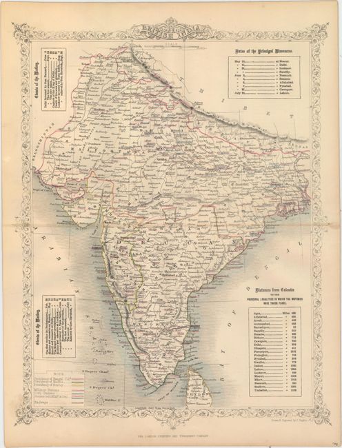
A. British India, by John Rapkin, circa 1859, hand color (10.2 x 13.1"). This map is based upon Tallis, but has been updated to reflect the conflicts in the region. The vignettes that typically surround the map have been replaced with tables showing the "Extents of the Mutiny," the "Dates of the Principal Massacres," and the "Principal Localities in which the Mutinies Have Taken Place." A legend identifies via hand colored lines the various presidencies of the country, military stations, civil stations, and railroads. Condition: Original outline color on a clean sheet with a centerfold separation at right that just passes the neatline. (B+)
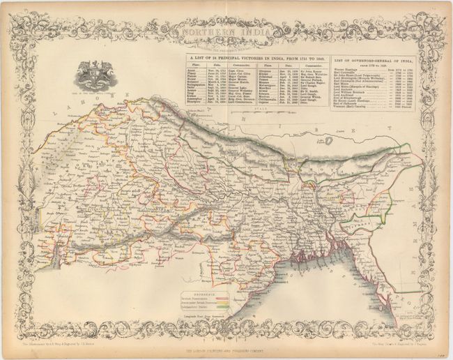
B. Northern India, Including the Presidency Bengal, by John Rapkin, circa 1859, hand color (13.3 x 10.1"). Also based upon Tallis, this map depicts the northern portion of British-controlled India. It is color-coded to depict British possessions (red), states under British protection (yellow), and independent states (green). A table above the map lists the principal victories in India from 1751 to 1849 as well as a list of Governors to 1859. Condition: Original outline color on a clean sheet with faint toning along sheet edges. (A)
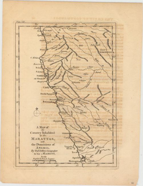
C. A Map of the Country Inhabited by the Marattas, with the Dominions of Angria, by Thomas Jefferys, circa 1757, black & white (6.3 x 8.8"). This small map depicts the western coast of India from Surat to Goa. It shows basic detail of place names, topography and drainage. The map was published in An Account of the War in India, between the English and French, on the Coast of Coromandel, from the year 1750 to the year 1760. Condition: A strong impression with light offsetting from an opposing page of text and one small manuscript name added to the map. (B+)
References:
Condition:
See description above.