Subject: Nagasaki, Japan
Period: 1763 (circa)
Publication: Petit Atlas Francois
Color: Black & White
Size:
13.1 x 7.7 inches
33.3 x 19.6 cm
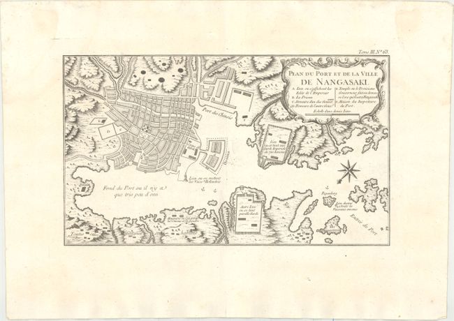
Bellin's smaller version of this great plan of Nagasaki. The map is oriented to the southwest with a bold compass rose. The map locates the principal points of interest and major buildings. The Desima is central to the map. This artificial island in the bay of Nagasaki was where the VOC (Dutch East India Company) were allowed to trade with the representatives of the Shogun in Edo. Locates a large Temple complex at the end of the bay. The rococo-style title cartouche incorporates the key to locations.
References: Walter #101.
Condition: B+
A fine impression on watermarked paper with very faint offsetting along the centerfold and a faint damp stain in the top left corner of the map image.