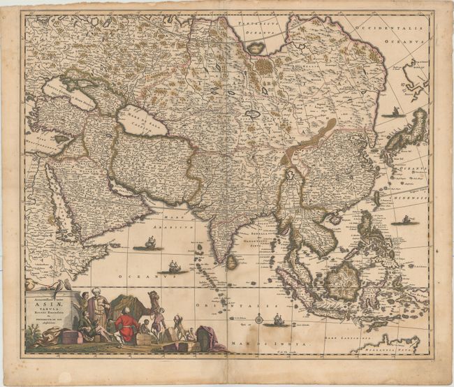
Subject: Asia
Period: 1680 (circa)
Publication:
Color: Hand Color
Size:
22.7 x 19.3 inches
57.7 x 49 cm
This handsome, large map of the continent and East Indies shows the extent of European knowledge of the region. It is vividly rendered with good detail throughout the south and south east, due to the surveys of the Dutch East India Company, while northern and central Asia is filled mostly with mountains, deserts and forests. The work of the Jesuit missionaries is reflected in the well-documented region of China. The large title cartouche includes a busy scene including traders with their exotic cargo.
References: Yeo #59.
Condition: B
Full original color with a couple of tiny holes along the centerfold, a stain at bottom right, and a chip in top blank margin. There are archival repairs to a centerfold separation at bottom and to two short tears adjacent to the centerfold. There are remnants of paper glued to the edges of the sheet on verso.