Subject: Holy Land
Period: 1650 (circa)
Publication: A Pisgah-Sight of Palestine
Color: Hand Color
Size:
12.9 x 11.2 inches
32.8 x 28.4 cm
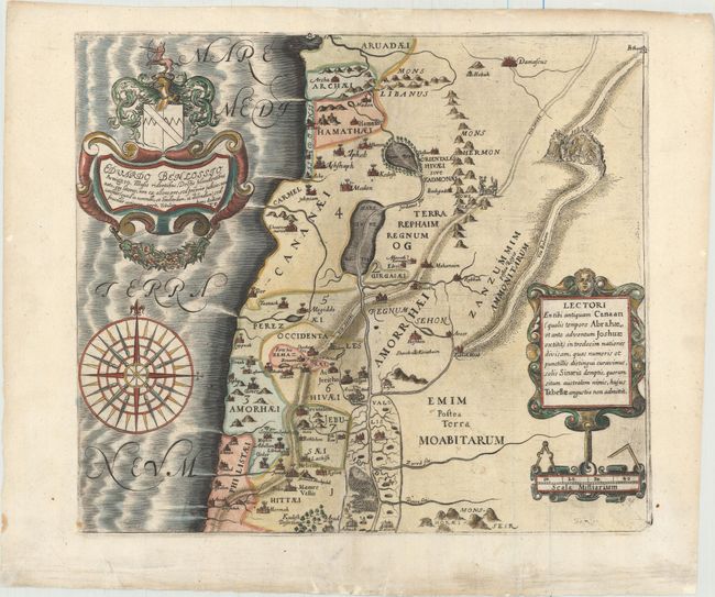
This map of the old Canaan shows Palestine on both sides of the Jordan prior to the conquest by the Children of Israel, extending from Arua in the north to Azzah in the south. The map is adorned with an elaborate coat of arms and dedication to Eduardo Benlossio and a large compass rose.
Thomas Fuller (1608-1661) was a respected English clergyman who wrote several books on the history and geography of the Holy Land. His A Pisgah-Sight of Palestine, published in 1650 and again in 1662, was a geographical description of the Holy Land with special reference to biblical history. The maps were derived from the cartography of Adrichom supplemented by his own wide reading. Fuller financed the book by dividing it into sections and finding sponsors for each one. To acknowledge the patrons, all maps contained decorative cartouches with the sponsor's coat of arms and a dedication to him.
References: Laor #279; Nebenzahl (HL) p.128-131, #2; Shirley (BL Atlases) G.FULL-1a #1.
Condition: B+
A nice impression on watermarked paper with wide margins and attractive color. There are several worm tracks and a short tear in the image that have been professionally repaired, with a minor amount of image replaced in facsimile.