Subject: Cyprus
Period: 1619 (published)
Publication: Gerardi Mercatoris - Atlas sive Cosmographicae
Color: Hand Color
Size:
19.4 x 13.9 inches
49.3 x 35.3 cm
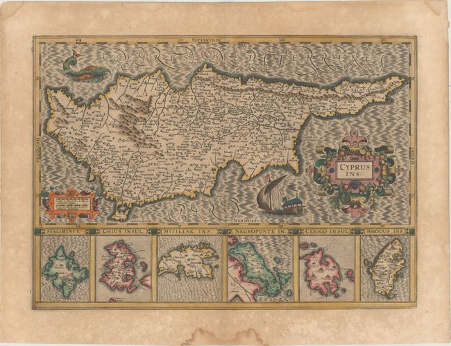
This superb map of the island of Cyprus is geographically based on the earlier work of Ortelius. This map was added to Mercator's Atlas by Hondius, as Mercator never published a map of Cyprus. Hondius changed the orientation from Ortelius' map, likely influenced by Ptolemy. The beautiful composition of the map makes it one of the most desirable maps of the island. At bottom are inset maps of five Greek islands: Lemnos, Chios, Lesbos, Evia, Kythira, and Rhodes. The map itself is handsomely adorned with a sea monster, a sailing ship, two strapwork cartouches, and a moire patterned sea.
References: Stylianou, pp. 83-85, 290; Van der Krogt (Vol. I) #8130:1A.
Condition: B+
A dark impression with full original color, light toning, and scattered foxing primarily confined to the blank margins. There are several damp stains in the blank margins, far from the image.