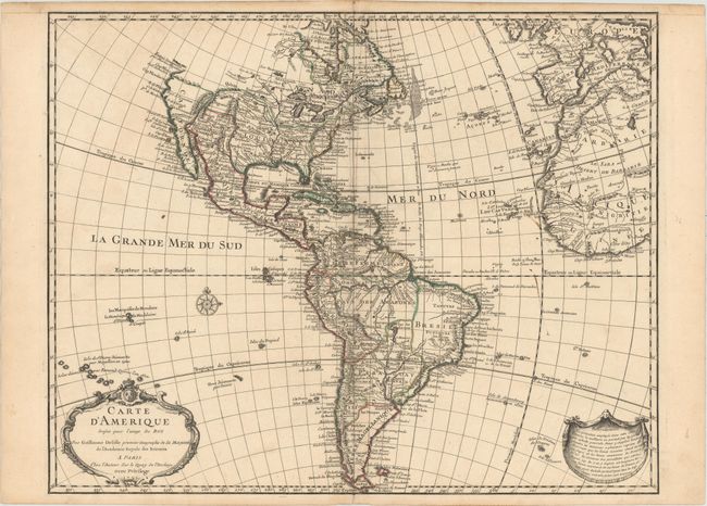
Subject: Western Hemisphere - America
Period: 1722 (dated)
Publication:
Color: Hand Color
Size:
24.1 x 19.2 inches
61.2 x 48.8 cm
This detailed map of the Americas is one of the most popular maps of the 18th century and provides a great deal of information about the state of geographic knowledge in the New World in the early part of the century. In North America the western coast is blank above California. The French territory of Louisiane takes up the lion's share of North America at the expense of the British colonies. This political bias is due to Delisle's position as geographer to the King of France. South America is well represented with a good depiction of the river systems and the locations of the Jesuit missions. The is the second state with d'Amerique in block-style lettering in the title cartouche. The map has a long publishing history that spans nearly 100 years!
References: Tooley (Amer) p. 13, #2; Portinaro & Knirsch CXIV.
Condition: B+
A dark impression with original outline color on watermarked paper. There are two clean cuts adjacent to the centerfold that extend from the top of the map to the Caribbean that have been professionally repaired. The top margin was also cleanly cut off and has been professionally reattached.