Subject: Western Hemisphere - America
Period: 1661 (circa)
Publication: Introductio in Universam Geographicam
Color: Hand Color
Size:
10.3 x 8.3 inches
26.2 x 21.1 cm
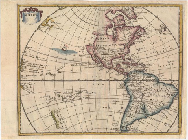
This handsome small map was derived from the Nicolas Visscher map of 1658, with a Blaeu type Great Lakes region and a Briggs type island of California. A depiction of the discoveries of Maarten Gerritsz de Vries' voyage appears in the water north of Japan, and Abel Janszoon Tasman's discoveries are shown in New Zealand. This is the first state of the map, decorated by a simple drape style title cartouche without engraver's imprint and a sailing ship in the Pacific Ocean.
Cluver's Introductio in Universam Geographicam was a popular atlas, appearing in over 45 editions during a 100-year period. The first edition was published without maps in the 1620s, and the first edition to include maps was published circa 1641. The various editions were published in different cities throughout Europe, including Amsterdam, Nuremberg, and London.
References: Burden #360, State 1; McLaughlin #25, State 1.
Condition: B+
Issued folding on watermarked paper with attractive color and a few minor creases at bottom right. There are professional repairs to a couple of tiny separations along the folds and short adjacent tears. Remargined at bottom and right with a portion of neatline replaced in facsimile.