Catalog Archive
Auction 154, Lot 488

"Gouvernement General de Normandie Divise en ses Sept Bailiages de Coutances, Caen, Caux, Rouen, Evreux, Gisors, et Alencon", Robert de Vaugondy, Gilles

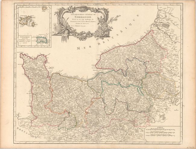
Subject: Northern France

Period: 1751 (circa)

Publication: Atlas Universel

Color: Hand Color

Size:
23 x 19 inches
58.4 x 48.3 cm
Download High Resolution Image
(or just click on image to launch the Zoom viewer)

Finely engraved map showing all of the Normandy coast and well inland with detail of hundreds of villages, towns, and roads. The political divisions are based on the manuscripts of Sanson. At upper left is an inset, "Supplement pour les Isles Grenezey et Jersey, appartenantes aux Anglois," showing the Channel Islands. Decorated with a title cartouche in the rococo-style with plants and fruits.

References: Pedley #101.

Condition: A

Original outline color on watermarked paper with a few faint spots, a short printer's crease adjacent to the centerfold at bottom, and light toning along the edges of the sheet.

Estimate: $90 - $120

Sold for: $40

Closed on 9/16/2015

Archived