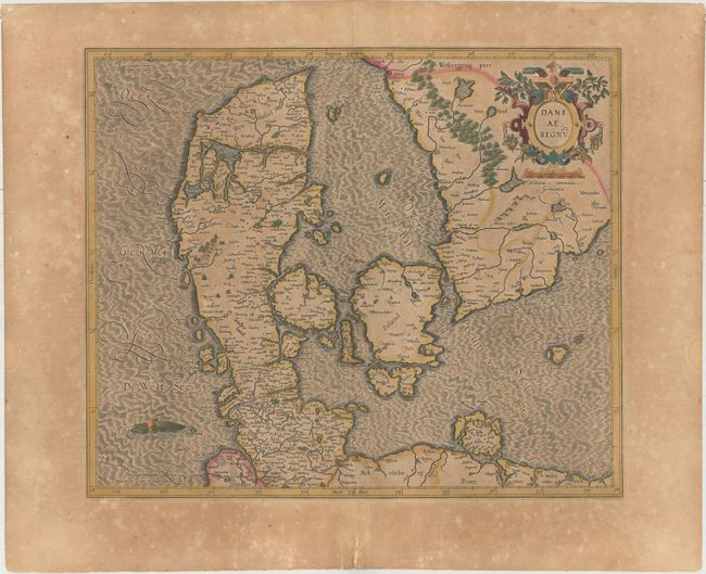
Subject: Denmark
Period: 1619 (published)
Publication: Gerardi Mercatoris - Atlas sive Cosmographicae
Color: Hand Color
Size:
17.4 x 14.8 inches
44.2 x 37.6 cm
This is Mercator's first map of Denmark and southern Sweden, which became the standard map of the region for the 17th century, and was replaced in 1636. The seas are engraved in a moiré pattern with a sea monster at bottom left. The legendary city of Wineta (Vineta) is shown off the Pomeranian coast near Damerow. This fabled trading city is mentioned in ancient texts and legends and in the 16th century it began to appear on printed maps of the Baltic, in a variety of locations. French text on verso.
References: Van der Krogt (Vol. I) #1500:1A.1.
Condition: B
Full original color on watermarked paper with toning, a 1" tear in the Kattegat that has been archivally repaired, and light scattered foxing primarily confined to the blank margins.