Catalog Archive
Auction 154, Lot 447
"Carte d'Irlande Divisee en Provinces et Comtes sur Laquelle on a Marque les Grands-Chemins, les Chemins de Traverse, et les Distances, en Milles Anglaia, des Principaux Lieux a Dublin", Depot de la Marine
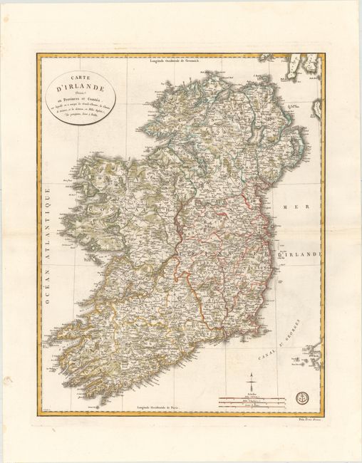
Subject: Ireland
Period: 1803 (circa)
Publication:
Color: Hand Color
Size:
20.4 x 25.8 inches
51.8 x 65.5 cm
Download High Resolution Image
(or just click on image to launch the Zoom viewer)
(or just click on image to launch the Zoom viewer)