Subject: Southern Scotland
Period: 1663 (circa)
Publication: Sixieme Volume de la Geographie Blaviane
Color: Hand Color
Size:
20.5 x 16.5 inches
52.1 x 41.9 cm
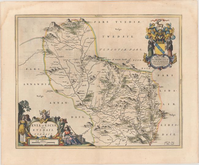
This beautifully engraved map covers Eskdale, a subdivision of the county of Dumfriesshire within the Scottish Borders. The map includes great detail of the rivers, cities, villages and castles and is based on the work of Timothy Pont, who conducted an important survey of Scotland in the late sixteenth century. Two large, lovely cartouches adorn the map, both featuring illustrations of animals and regional figures. French text on verso, published between 1663-67.
References: Van der Krogt (Vol. II) #5817:2.
Condition: A
A dark impression with full original color, light printer's ink residue, and minor show-through of text on verso. There are several soft creases in the top blank margin.