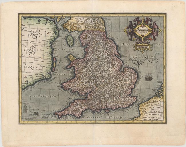
Subject: England & Wales
Period: 1609 (circa)
Publication: Gerardi Mercatoris - Atlas sive Cosmographicae
Color: Hand Color
Size:
18.4 x 13.8 inches
46.7 x 35.1 cm
This attractive map of Elizabethan England is filled with names taken from Saxton's map of 1579. County boundaries and the Latinized names of counties are shown. The map is beautifully engraved in Mercator's characteristic style featuring a stipple engraved sea with a sailing ship, bold calligraphy and a handsome title cartouche. French text on verso, published between 1609-19.
References: Shirley (BI to 1650) #181; Van der Krogt (Vol. I) #5100:1A.1.
Condition: A
A crisp, dark impression on watermarked paper with attractive color and several minor printer's creases at right. There are archival repairs to a couple of short centerfold separations, and two small worm holes in top blank margin, and a short edge tear at bottom.