Subject: Isle of Wight
Period: 1803 (dated)
Publication:
Color: Hand Color
Size:
35.8 x 24.4 inches
90.9 x 62 cm
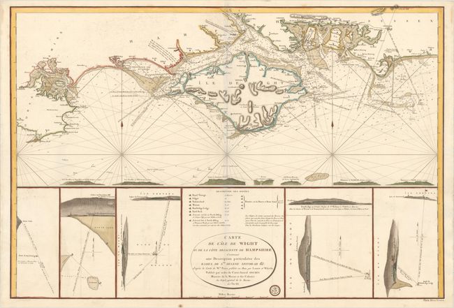
This uncommon large-scale chart depicts the Isle of Wight and the coastline of mainland England from St. Alban's Head to just east of Selsey Bill. The chart is based on a map by William Price, published by Laurie & Whittle in 1800. The chart is filled with navigational information, including soundings, rocks, shoals, and safe anchorages, with numerous place names along the coast. At bottom are several land approach views complete with detailed information regarding buoys used to aid in navigation. The buoys are further listed above the title. The engraved Depot de la Marine seal appears below the title, and the price is at bottom right: Prix. Deux Francs.
References:
Condition: A
A bright sheet with wide margins and minor offsetting. This is a faint blue shadow along the centerfold that is caused by our scanner and does not appear on the map itself.