Catalog Archive
Auction 154, Lot 427

NO RESERVE

"A Mapp of ye County of Midlesex with Its Hundreds", Blome, Richard

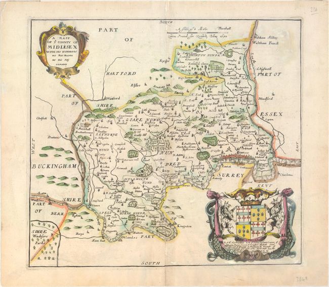
Subject: London, Southeast England

Period: 1672 (dated)

Publication: Britannia

Color: Hand Color

Size:
12.3 x 11.1 inches
31.2 x 28.2 cm
Download High Resolution Image
(or just click on image to launch the Zoom viewer)

This lovely map depicts the former county of Middlesex in southeast England. The map divides the county into hundreds and names several towns, villages, and cities. London is depicted as a cluster of buildings on the Thames, with Hyde Park, St. James's Park, Isle of Dogs, and Westminster identified nearby. There is nice topographical detail throughout the map. A decorative strapwork title cartouche appears in the top left corner, and there is a coat-of-arms and dedication encased in an elaborate cartouche at bottom right.

Richard Blome is one of the most interesting figures in cartographic history. He is most renowned for what his contemporaries considered the plagiarism of the maps in the Britannia from Camden and Speed. In actuality Blome did not claim that the maps were original works, and the atlas filled an important gap in the market. In the preface he wrote, "I do not own myself the Author, but the Undertaker of this work". He was one of the most active publishers of illustrated books in post-Restoration London and his career provides in insight into the nature and activities of the London map and print trade of the period. There is an excellent biography on MapForum.com MapForum.com.

References:

Condition: B+

On watermarked paper with an archivally repaired centerfold separation at bottom and a few minor spots.

Estimate: $240 - $325

Unsold

Closed on 9/16/2015

Archived