Subject: Southeast England
Period: 1831-44 (circa)
Publication:
Color: Hand Color
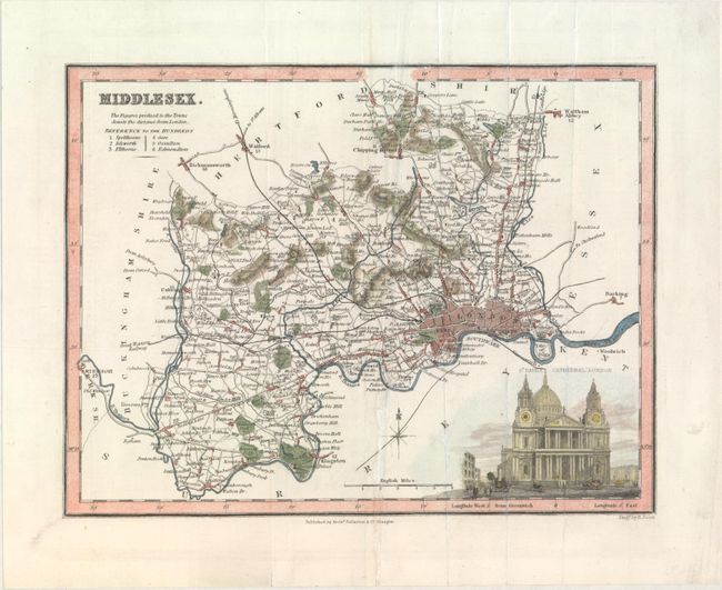
A. Middlesex, by Archibald Fullarton & Co., circa 1836 (9.4 x 7.3"). This small map depicts the former county of Middlesex. London is shown in plan form, and hundreds, roads, railroads, parks, hills, and several towns and cities are identified. A view of St. Paul's Cathedral appears at bottom right. Engraved by R. Scott. Condition: There are some extraneous creases and a short archivally repaired centerfold separation confined to the bottom blank margin.
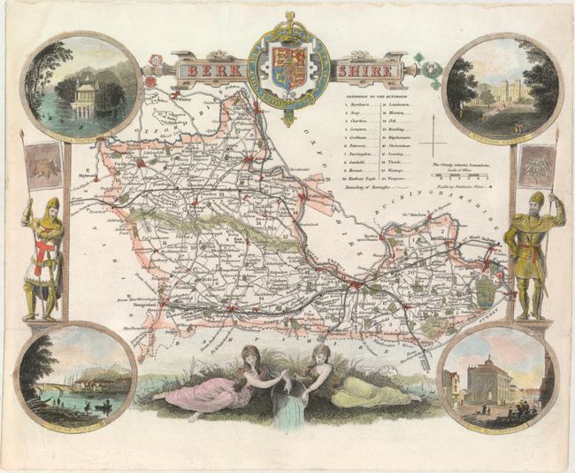
B. Berkshire, by Thomas Moule, circa 1844 (10.1 x 7.8"). This striking small map of the county of Berkshire is filled with decorative detail. The hundreds, place names, roads, and railroads are shown. The royal coat-of-arms of the United Kingdom appears in the middle of the title. A decorative border surrounds the map featuring two knights at left and right, maidens in a riverside scene at bottom, and four views at the corners depicting Virginia Waters, Windsor Castle, Windsor, and Abingdon-on-Thames' town hall.
Thomas Moule (1784 – 1851) was a writer, bookseller, publisher, topographer and a scholar in heraldry. His varied career led him in 1830 to produce a series of English county map based on his own travel. He wrote that he has “with expensive diligence personally visited every county in England, excepting only Devonshire and Cornwall.” His maps were delicately engraved on steel in a highly decorative style, featured such embellishments as armorial bearings, figures, fancy borders and vignettes of local interest. This amount of ornamentation in mapmaking was unusual for the period as most mapmaker’s were instead creating scientifically accurate, austere works. His series of county maps were originally published in separate sections for each county (1830-32), then subsequently published in a two-volume work: The English Counties Delineated…, (1836). Beginning in 1841, the maps appeared in Barclays Complete and Universal English Dictionary. Condition: There are fold separations at left and right that have been closed on verso with archival tape, as well as a short archivally repaired edge tear in the top blank margin.
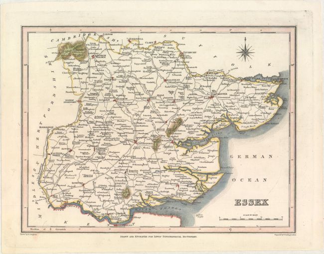
C. Essex,by Samuel Lewis, from Lewis' Topographical Dictionary, circa 1831 (9.1 x 6.9"). This small map covers the county of Essex in southeast England. Plenty of towns and cities are named, including Colchester, Chelmsford, Braintree, and Halsted, and roads and topographical detail are shown. The North Sea is here called German Ocean. Drawn by R. Creighton and engraved by Thomas Starling. Condition: A fine impression.
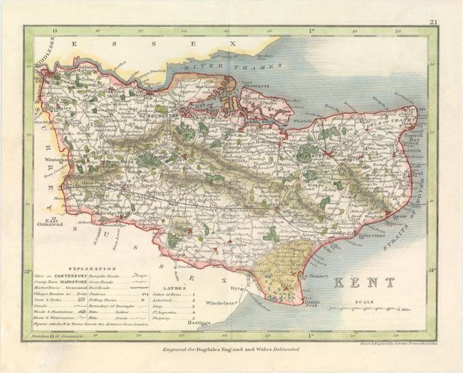
D. Kent, by Joshua Archer, from Dugdales England and Wales Delineated, circa 1842 (9.2 x 7.0"). This small map of the county of Kent in southeast England is teeming with detail. A key at bottom left identifies cities, county and market towns, villages, parks, canals, roads, railroads, polling places, and more. The county is subdivided into lathes. Condition: There is a tiny hole in the center of the map that has been closed on verso with archival materials.
References:
Condition: A
See description above.