Subject: Bay of Biscay, Celtic Sea
Period: 1666 (circa)
Publication: De Zee-Atlas, Ofte Water-Woereld...
Color: Hand Color
Size:
21 x 17.3 inches
53.3 x 43.9 cm
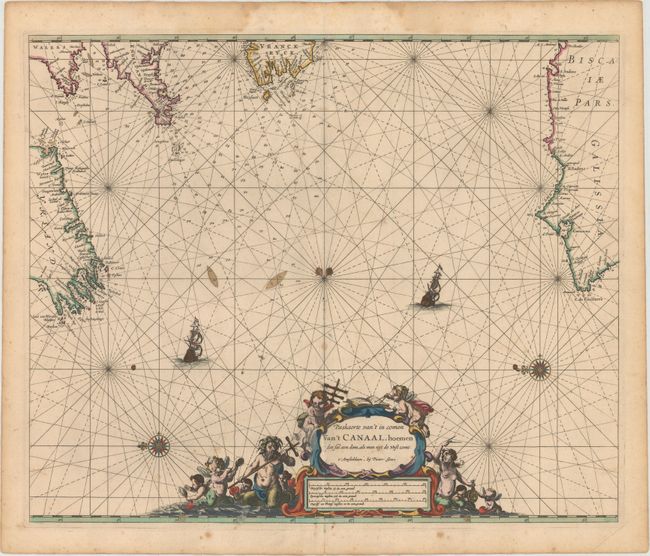
This sea chart focuses on the Celtic Sea and Bay of Biscay in between Ireland and Spain, with portions of the coastlines of Wales, England, and France depicted as well. Place names appear along the coasts, and within the water there are numerous soundings and anchorages. Two compass roses capped with fleurs-de-lis radiate rhumb lines and orient north to the left. Two sailing ships are shown in the water. An elaborate title and distance cartouche, featuring Neptune and various putti, balances the composition at bottom.
Pieter Goos was one of Amsterdam's most successful publishers of nautical charts, with an impressive international clientele of shipowners, officials, and navigators. Only the publishing houses of Blaeu and Van Keulen shared a comparable esteem. His maritime atlas of the world was one of the most complete sea atlases published prior to the appearance of Van Keulen's Zeefakkel in the 1680’s.
References: Putnam, pp. 99-100.
Condition: B+
A nice impression in original color, backed with old paper as issued, with a few small stains and minor soiling. There are damp stains confined to the top blank margin and a centerfold separation at bottom that does not enter into map image.