Subject: Peru
Period: 1719 (dated)
Publication: Atlas ou Recueil de Cartes Geographiques
Color: Hand Color
Size:
23 x 19.2 inches
58.4 x 48.8 cm
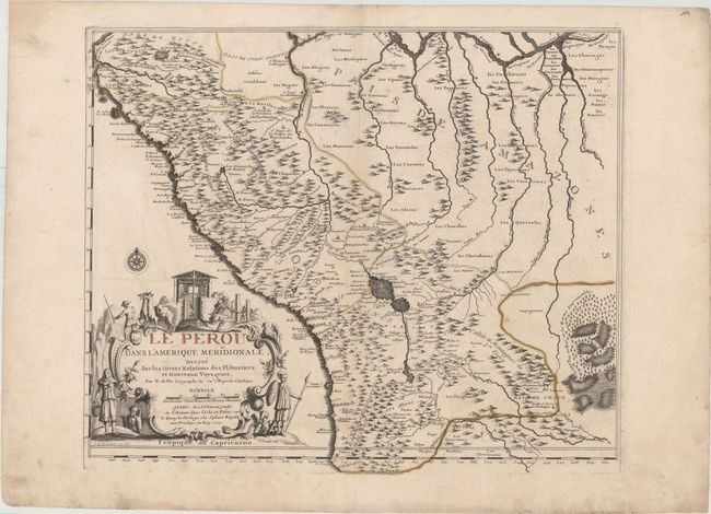
This uncommon map of Peru extends to include western Brazil and Bolivia. The mountainous topography of Peru is illustrated along with numerous rivers, lakes, and towns. Lac de Titicaca and Lac Paria (Lago de Poopo) are shown, as well as a fictional, unnamed northern lake. In Pais des Amazones (Brazil), an extensive system of rivers is depicted which are much too wide and long. The Maragnan R. (Maranon River) is shown much too far south. At lower right is a vast region noted as impassable woods and marshes. The map is adorned with an elaborate title cartouche that illustrates the extensive mining activities in the region, along with llamas and natives. Engraved by Pierre de Rochefort.
References: Pastoureau, FER II C [99].
Condition: B+
Original color on watermarked paper with wide margins. There is light soiling, faint color offsetting, and professional repairs to several short separations along the centerfold and some chips confined to the blank margins.