Subject: Northern South America & Lesser Antilles
Period: 1598 (circa)
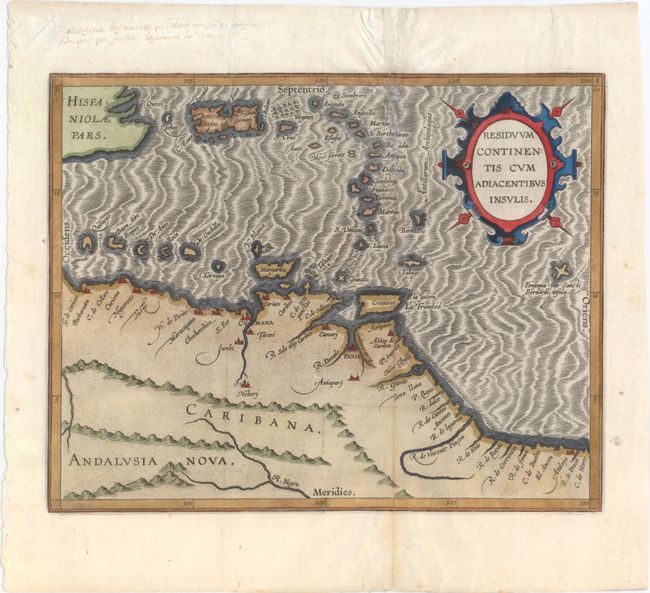
Publication: Descriptionis Ptolemaicae Augmentum…
Color: Hand Color
Size:
11.4 x 9 inches
29 x 22.9 cm
This map of the southern Caribbean islands and the coastline of Venezuela appeared in Wytfliet's Descriptionis Ptolemaicae Augmentum…, which is considered the earliest atlas to focus on the Americas. Wytfliet's work was referred to as a continuation of Ptolemy, despite the fact that there was no connection with Ptolemy except for his name on the title page. Wytfliet compiled his atlas using multiple published sources, including Ramusio, Hakluyt and De Bry. This map depicts coastal towns, rivers and the mountainous topography of Venezuela, and is adorned with a strapwork cartouche and a moiré-patterned sea.
References: Phillips (Atlases) #1140 & #3644-8; Nordenskiold #307-8.
Condition: B+
A nice impression with attractive color. Issued folding with professional repairs to some tiny holes and separations along the folds.