Subject: Barbados
Period: 1782 (dated)
Publication: Political Magazine
Color: Hand Color
Size:
14.5 x 11.2 inches
36.8 x 28.4 cm
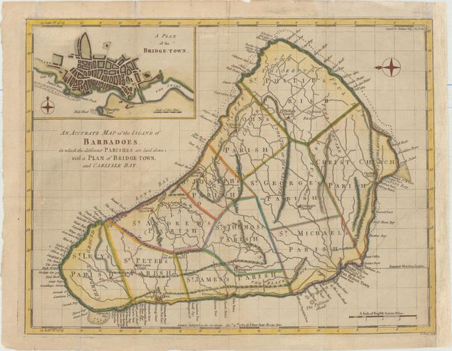
This rare map is based on William Mayo's important survey of the island between 1717 and 1721. Mayo's was the second systematic, and first large-scale survey and it fixed the legal bounds of the parishes. It was not until the Admiralty survey of 1873 that Mayo's map ceased to be the standard representation for maps of Barbados. The map shows the eleven parishes and depicts the ports, settlements, forts, churches, and roads. At top left is an inset depicting a bird's-eye plan of Bridgetown. A compass rose orients north to the left. This map was published in the Supplement to the Political Magazine, and is thus quite uncommon.
References: Campbell (MCC-21) #43; Jolly #POL-43.
Condition: B+
Issued folding, now pressed, on watermarked paper with some light creasing and professional repairs to several short fold separations and tiny tears in the blank margins. Remargined at right to accommodate framing.