Catalog Archive
Auction 154, Lot 329

"Pas Kaart van de Noord Kust van Espaniola met d Eylanden daar Benoorden...", Keulen, Johannes van

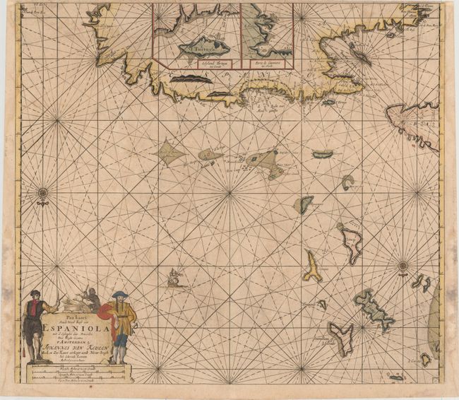
Subject: Greater Antilles

Period: 1692 (circa)

Publication:

Color: Hand Color

Size:
22.2 x 20.4 inches
56.4 x 51.8 cm
Download High Resolution Image
(or just click on image to launch the Zoom viewer)

This handsome sea chart depicts the northern part of Hispaniola, the eastern end of Cuba, the adjacent Turks and Caicos Islands, and the southern Bahamas as far north as San Salvador. Presented on an unusual projection, north is oriented to the bottom of the sheet. There are two large insets providing details of Tortuga Island and Port of Guanives. The map is adorned with a compass rose, sailing ship, and a figurative cartouche flanked by two swashbuckling pirates.

References:

Condition: B+

A dark impression with attractive color, light soiling, and minor offsetting. There are damp stains around the sheet's edges that just enter the neatline in a few places.

Estimate: $800 - $950

Unsold

Closed on 9/16/2015

Archived