Subject: Southwestern United States, Mexico & Central America
Period: 1849 (circa)
Publication:
Color: Black & White
Size:
11.1 x 8.9 inches
28.2 x 22.6 cm
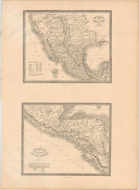
Contains two maps on one sheet, each measuring 11.1 x 8.9". The top image covers the region from northern California south to Guatemala and depicts the political divisions of Mexico. There is good detail of topography and the river system with a note in the Great Basin stating "L. Youtaw probably L. Timpanogos of the Spaniards." A table at bottom left shows the population and square miles of the provinces of Mexico. The bottom image shows Central America, extending from the southern half of Mexico to Panama. Both maps are decorated by a fancy title cartouche and surrounded by a keyboard style border. Engraved by Stockley. The sheet is accompanied by a full page of descriptive text.
References:
Condition: A
A clean sheet with a few edge tears at bottom.